See exactly where property lines fall on the ground using augmented reality on your iPhone.
Download ParcelVisionPacific Northwest properties are blanketed in dense evergreen forest and steep terrain where boundary markers are hidden under moss, ferns, and decades of undergrowth. Timber rights, conservation easements, and forest management all depend on precise boundaries that are nearly impossible to walk without visual aids.
Alaska's vast boroughs and census areas cover some of the most remote terrain in the country, making boundary identification uniquely challenging.
ParcelVision lets you see property boundary lines in Matanuska-Susitna Borough right on the ground using your iPhone's camera and augmented reality. Point your phone, and the boundary lines appear in real space — across old-growth forests, rain-soaked hillsides, and timber country.
Population
Land Area
Get ParcelVision free from the App Store.
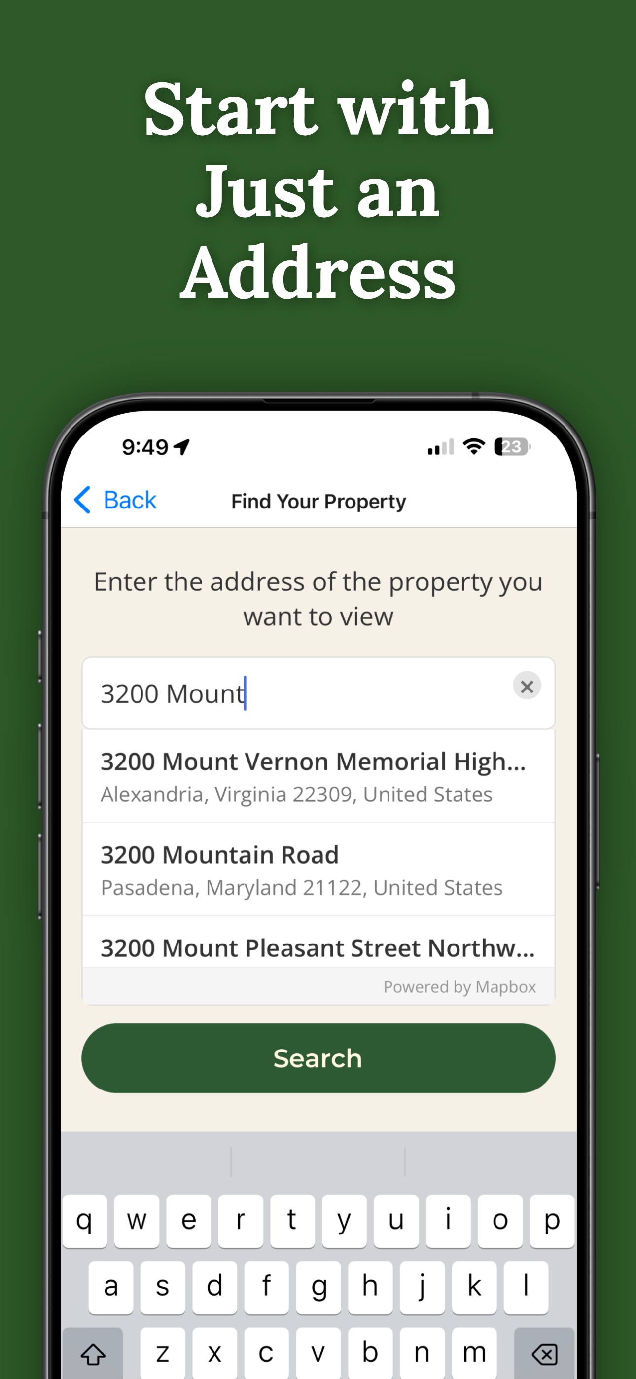
Search for any address in Matanuska-Susitna Borough and purchase access for $14.99.
Point your iPhone camera and see property lines overlaid on the real world.
Thick evergreen canopy hides everything. AR lines stay visible through the trees.
Keep logging operations within property limits with real-time AR boundaries.
Share property access with forestry teams or logging crews at no extra cost.
Pay once per parcel. No subscriptions, no recurring fees.

ParcelVision uses official county parcel data and GPS to overlay boundary lines in augmented reality. While not a replacement for a professional survey, it gives you a reliable visual reference accurate to within a few feet.
Modern iPhone GPS performs well under forest canopy. While extremely dense old-growth may slightly reduce accuracy, ParcelVision remains a reliable visual reference in Pacific Northwest timber country.
Yes. Once you purchase a property card, share it with your entire crew for free. No one else needs to pay or create an account.
ParcelVision costs $14.99 per property. This is a one-time purchase — no subscriptions or recurring fees. You can share access with anyone for free.
ParcelVision is currently available for iPhone. An Android version is coming soon — you can sign up for notification at parcelvision.app.
Download ParcelVision and see property lines in Matanuska-Susitna Borough on the ground.
Download ParcelVision ParcelVision