See exactly where property lines fall on the ground using augmented reality on your iPhone.
Download ParcelVisionPacific Coast properties range from dense suburban neighborhoods to vineyard-covered hills and rugged coastal bluffs, each with unique boundary challenges. High property values and strict building regulations make boundary accuracy critical for permits, easements, and real estate transactions.
California's 58 counties maintain some of the most detailed parcel records in the country, critical for the state's high-value real estate market.
ParcelVision lets you see property boundary lines in Tehama County right on the ground using your iPhone's camera and augmented reality. Point your phone, and the boundary lines appear in real space — across coastal bluffs, vineyards, and suburban hillsides.
Population
Land Area
Get ParcelVision free from the App Store.
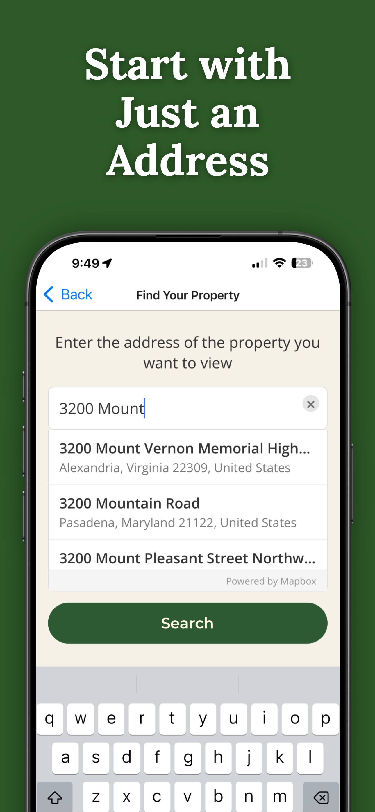
Search for any address in Tehama County and purchase access for $14.99.
Point your iPhone camera and see property lines overlaid on the real world.
See where your property ends on hillsides, bluffs, and complex terrain.
When every foot matters, AR boundary lines show you the exact property edge.
Send free access to your real estate agent, contractor, or buyer.
Pay once per parcel. No subscriptions, no recurring fees.

ParcelVision uses official county parcel data and GPS to overlay boundary lines in augmented reality. While not a replacement for a professional survey, it gives you a reliable visual reference accurate to within a few feet.
Yes. ParcelVision is a great tool for prospective buyers who want to walk a property and see the actual boundaries before committing to a purchase.
Yes. Once you purchase a property card, you can share it with anyone for free — your agent, buyers, family, or neighbors. No one else needs to pay.
ParcelVision costs $14.99 per property. This is a one-time purchase — no subscriptions or recurring fees. You can share access with anyone for free.
ParcelVision is currently available for iPhone. An Android version is coming soon — you can sign up for notification at parcelvision.app.
Download ParcelVision and see property lines in Tehama County on the ground.
Download ParcelVision ParcelVision