See exactly where property lines fall on the ground using augmented reality on your iPhone.
Download ParcelVisionGreat Plains properties cover expansive stretches of grassland and farmland where the horizon goes on for miles and property boundaries exist only on paper. With ranches spanning thousands of acres and minimal fencing, boundary disputes between neighbors are common and expensive to resolve with surveys.
Kansas property boundaries stretch across wide-open prairie and wheat fields where the nearest fence line may be miles from the actual property edge.
ParcelVision lets you see property boundary lines in Comanche County right on the ground using your iPhone's camera and augmented reality. Point your phone, and the boundary lines appear in real space — across wide-open grasslands, cattle ranches, and wheat fields.
Population
Land Area
Get ParcelVision free from the App Store.
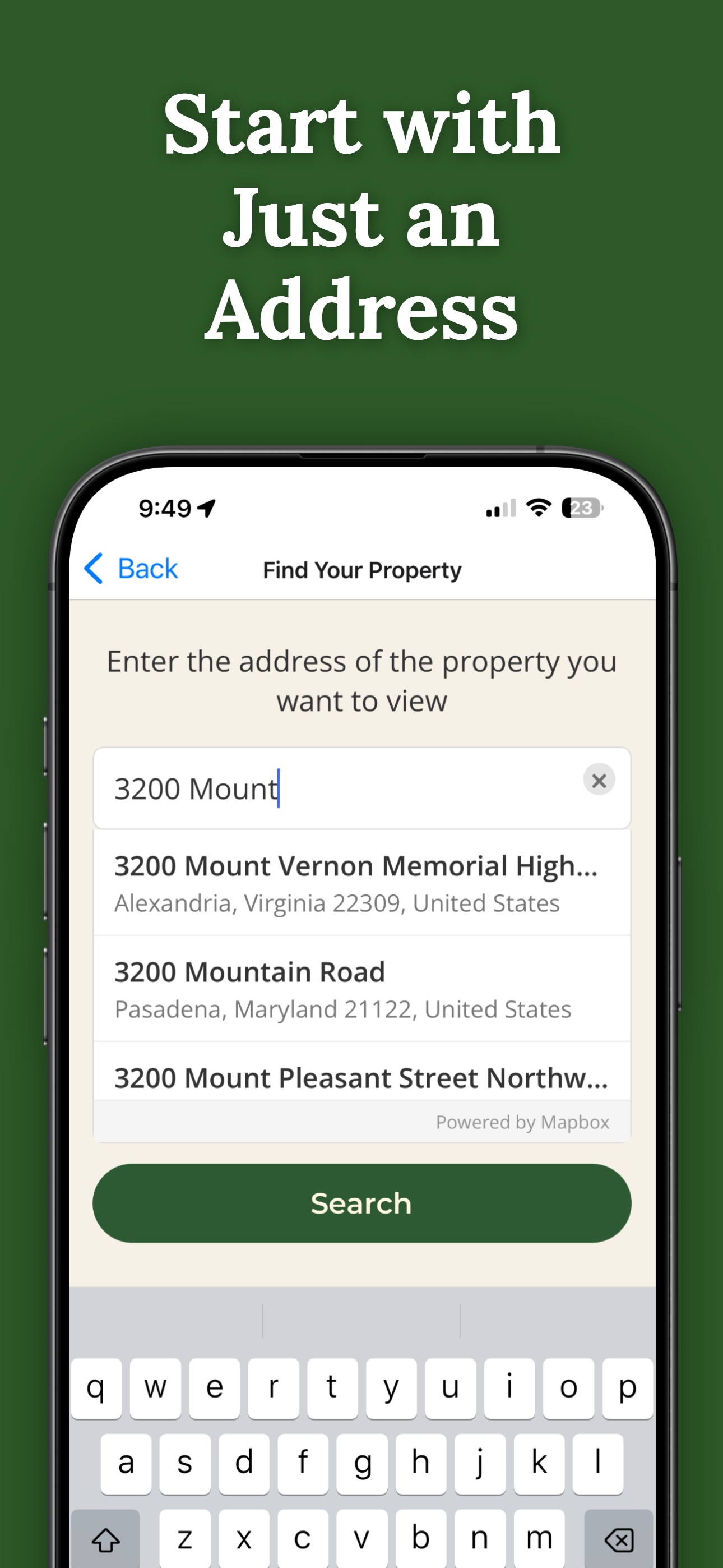
Search for any address in Comanche County and purchase access for $14.99.
Point your iPhone camera and see property lines overlaid on the real world.
No fences, no markers, no problem. AR shows you the line across open country.
Know exactly where your land ends and your neighbor's begins.
Share property access with ranch hands, family, or partners.
Pay once per parcel. No subscriptions, no recurring fees.

ParcelVision uses official county parcel data and GPS to overlay boundary lines in augmented reality. While not a replacement for a professional survey, it gives you a reliable visual reference accurate to within a few feet.
Yes. ParcelVision works on properties of any size. For large ranches, you can walk any section of the boundary and the AR lines will appear in real time showing you the property edge.
Yes. Once you purchase a property card, you can share it with anyone for free. They don't need to pay or create an account — just open the link you send them.
ParcelVision costs $14.99 per property. This is a one-time purchase — no subscriptions or recurring fees. You can share access with anyone for free.
ParcelVision is currently available for iPhone. An Android version is coming soon — you can sign up for notification at parcelvision.app.
Download ParcelVision and see property lines in Comanche County on the ground.
Download ParcelVision ParcelVision