See exactly where property lines fall on the ground using augmented reality on your iPhone.
Download ParcelVisionAppalachian properties follow the contours of ridges and valleys, where steep terrain and thick forest make boundary lines nearly impossible to spot on the ground. Hunting leases, timber rights, and family land divisions depend on knowing exactly where one property ends and another begins on challenging mountain terrain.
Kentucky property records reflect the state's complex terrain, from rolling Bluegrass horse farms to steep Appalachian coal country.
ParcelVision lets you see property boundary lines in Webster County right on the ground using your iPhone's camera and augmented reality. Point your phone, and the boundary lines appear in real space — across ridgelines, hollers, and rugged mountain terrain.
Population
Land Area
Get ParcelVision free from the App Store.
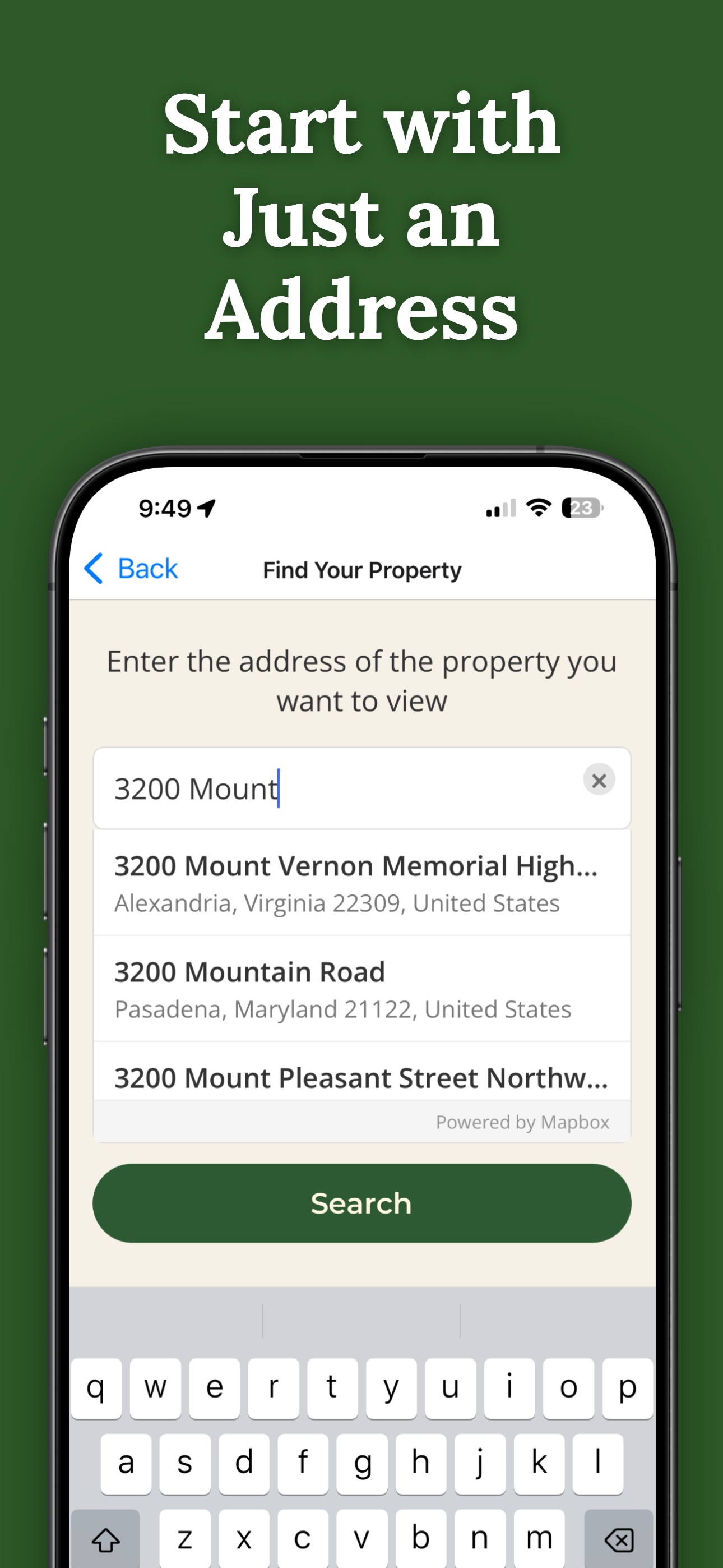
Search for any address in Webster County and purchase access for $14.99.
Point your iPhone camera and see property lines overlaid on the real world.
See boundary lines even on steep ridges and in deep hollers where markers vanish.
Know exactly where the property line is so you stay on legal ground.
Ensure logging stays within property limits with visual AR confirmation.
Pay once per parcel. No subscriptions, no recurring fees.

ParcelVision uses official county parcel data and GPS to overlay boundary lines in augmented reality. While not a replacement for a professional survey, it gives you a reliable visual reference accurate to within a few feet.
Yes. The AR visualization adapts to elevation changes and works on hillsides, ridges, and valleys. Your phone's sensors track your position and orientation regardless of slope.
Yes. Once you purchase a property card, share it with your entire hunting party for free. No one else needs to pay or create an account.
ParcelVision costs $14.99 per property. This is a one-time purchase — no subscriptions or recurring fees. You can share access with anyone for free.
ParcelVision is currently available for iPhone. An Android version is coming soon — you can sign up for notification at parcelvision.app.
Download ParcelVision and see property lines in Webster County on the ground.
Download ParcelVision ParcelVision