See exactly where property lines fall on the ground using augmented reality on your iPhone.
Download ParcelVisionCoastal properties face unique boundary challenges where waterfront lots, marsh edges, and shifting shorelines make traditional property markers unreliable. Rising property values and waterfront development make it essential to know exactly where your land begins and ends, especially near tidal boundaries.
South Carolina properties range from Lowcountry marshes to Upstate foothills, with plantation-era lot lines still defining many boundaries.
ParcelVision lets you see property boundary lines in Colleton County right on the ground using your iPhone's camera and augmented reality. Point your phone, and the boundary lines appear in real space — across coastal marshes, barrier islands, and lowcountry terrain.
Population
Land Area
Get ParcelVision free from the App Store.
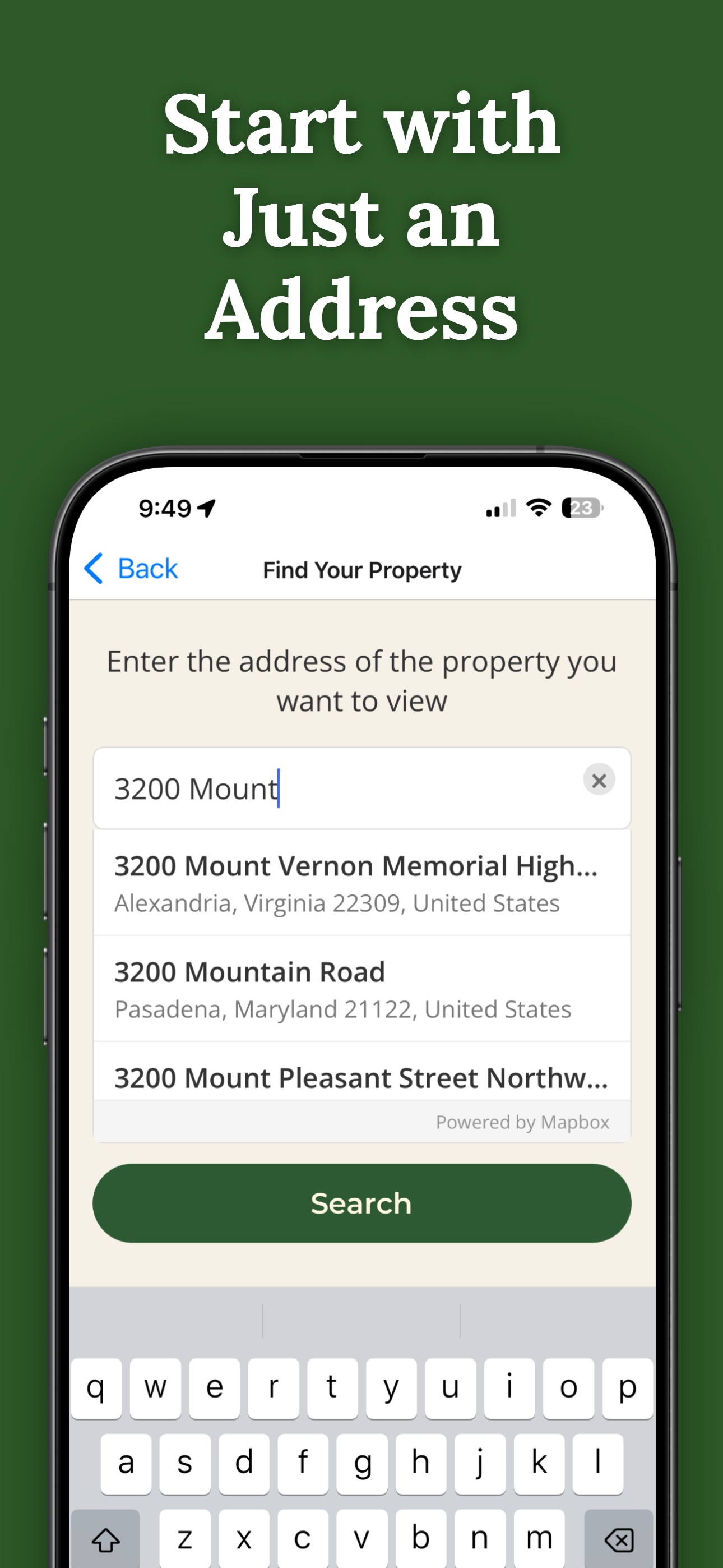
Search for any address in Colleton County and purchase access for $14.99.
Point your iPhone camera and see property lines overlaid on the real world.
See where your property ends and the waterfront begins with AR boundary lines.
Coastal properties are valuable. Know your exact boundaries before building or selling.
Send free access to your real estate agent or buyer.
Pay once per parcel. No subscriptions, no recurring fees.

ParcelVision uses official county parcel data and GPS to overlay boundary lines in augmented reality. While not a replacement for a professional survey, it gives you a reliable visual reference accurate to within a few feet.
ParcelVision shows the property boundary lines from official county records. Waterfront boundaries may be affected by mean high water lines and tidal easements — consult a surveyor for exact water boundaries.
Yes. Once you purchase a property card, you can share it with anyone for free — your agent, buyers, family, or neighbors. No one else needs to pay.
ParcelVision costs $14.99 per property. This is a one-time purchase — no subscriptions or recurring fees. You can share access with anyone for free.
ParcelVision is currently available for iPhone. An Android version is coming soon — you can sign up for notification at parcelvision.app.
Download ParcelVision and see property lines in Colleton County on the ground.
Download ParcelVision ParcelVision