See exactly where property lines fall on the ground using augmented reality on your iPhone.
Download ParcelVisionSouth-central properties range from dense river bottomland to open prairie, creating boundary challenges across varied terrain that traditional maps struggle to capture. Family land, oil leases, and hunting rights all depend on boundary lines that are often poorly marked and disputed across generations.
Texas has 254 counties — the most of any state — with property boundaries crossing everything from Gulf beaches to West Texas desert to Piney Woods forests.
ParcelVision lets you see property boundary lines in Maverick County right on the ground using your iPhone's camera and augmented reality. Point your phone, and the boundary lines appear in real space — across mixed terrain from rolling hills to river bottoms and open range.
Population
Land Area
Get ParcelVision free from the App Store.
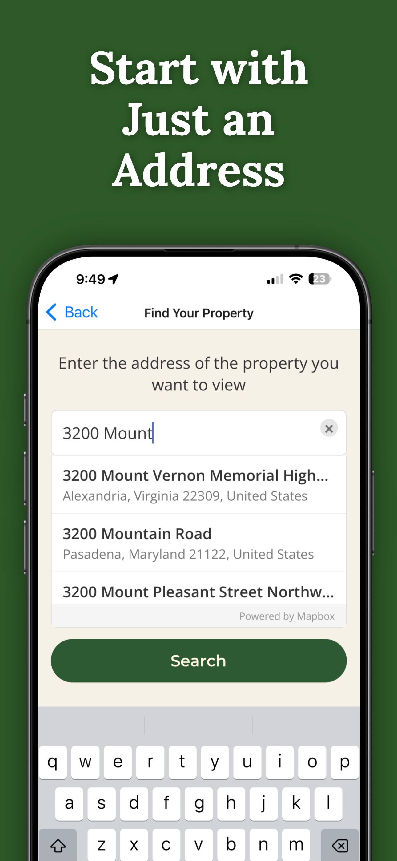
Search for any address in Maverick County and purchase access for $14.99.
Point your iPhone camera and see property lines overlaid on the real world.
From river bottoms to hilltops, AR boundary lines work everywhere.
Generations of subdivisions make boundaries unclear. See them with AR.
Share property access with family members at no extra cost.
Pay once per parcel. No subscriptions, no recurring fees.

ParcelVision uses official county parcel data and GPS to overlay boundary lines in augmented reality. While not a replacement for a professional survey, it gives you a reliable visual reference accurate to within a few feet.
You need a connection to initially load the property data, but once loaded, the AR visualization works using your phone's GPS and sensors even in areas with weak signal.
Yes. Once you purchase a property card, you can share it with anyone for free. They don't need to pay or create an account — just open the link you send them.
ParcelVision costs $14.99 per property. This is a one-time purchase — no subscriptions or recurring fees. You can share access with anyone for free.
ParcelVision is currently available for iPhone. An Android version is coming soon — you can sign up for notification at parcelvision.app.
Download ParcelVision and see property lines in Maverick County on the ground.
Download ParcelVision ParcelVision