ParcelVision
How to Find Your Property Lines Without a Survey
You can find property lines without hiring a surveyor by checking your deed, pulling up the plat map at your county recorder's office, looking at free GIS maps online, hunting for physical property pins in the ground, or using a property line app on your phone.
Surveys aren't cheap. Depending on where you live, you're looking at $300 to $800 for a basic residential lot — and several weeks of waiting. That's fine if you're settling a legal dispute or pulling a building permit, but it's overkill when you just want to know if that oak tree is on your side or your neighbor's.
Here are the ways to figure out your property lines without writing that check.
Start with Your Property Deed
Your deed has a legal description of your land baked right into it. It'll use one of three formats: metes and bounds (compass bearings and distances, like "N 45° E for 150 feet"), lot and block (a reference to a subdivision plat), or the rectangular survey system (township/range/section numbers common out west).
You can get your deed from the county recorder or clerk's office. Many counties have them online now, so you might not even need to leave your couch. Metes and bounds descriptions take some work to interpret, but lot and block references are easier — they just point you to a plat map that shows your lot's shape and dimensions.
Pull Up Your Plat Map
If your property is in a subdivision, the plat map is probably the single most useful document you can get your hands on. It's a scaled drawing showing every lot, with boundary dimensions, easements, and rights-of-way all laid out.
Find your lot number and check the dimensions along each boundary line. You'll also see if there are any easements or setbacks cutting into your usable space. We have a whole guide on how to read a plat map if you want to dig deeper into the symbols and notation.
Check Your County's GIS Map
This is the quickest option. Most US counties have a free GIS or parcel viewer website that draws property lines on top of satellite imagery. Google "[your county] GIS map" or "[your county] parcel viewer" and you'll usually find it on the first page of results.
Type in your address, and you'll see your lot outlined on the aerial photo. It's great for getting the big picture — lot shape, rough dimensions, where your property sits relative to roads and neighbors. Just don't treat these lines as gospel. They're pulled from recorded documents and can be off by a few feet, especially in rural areas with older surveys.
Hunt for Property Pins
When your lot was originally surveyed, the surveyor almost certainly drove iron pins or rebar into the ground at each corner. These are still there. They're just buried.
Property pins are typically 1/2" to 3/4" diameter iron rods, sometimes capped with a small plastic or metal disk stamped with a surveyor's license number. After years of soil buildup, mowing, and landscaping, they can be 6 to 12 inches underground. A cheap metal detector is the easiest way to find them — start at the corners of your lot based on what the plat map shows and sweep slowly. Once you find one pin, you can measure to the next corner to trace your lines. More on this in our guide to finding property pins and markers.
Just Ask Your Neighbors
Seriously. Your neighbor might have gotten a survey done last year and can show you exactly where the pins are. Or they might have a copy of their survey plat sitting in a drawer. A five-minute conversation can save you hours of detective work — and it tends to prevent the kind of misunderstandings that turn into disputes down the road.
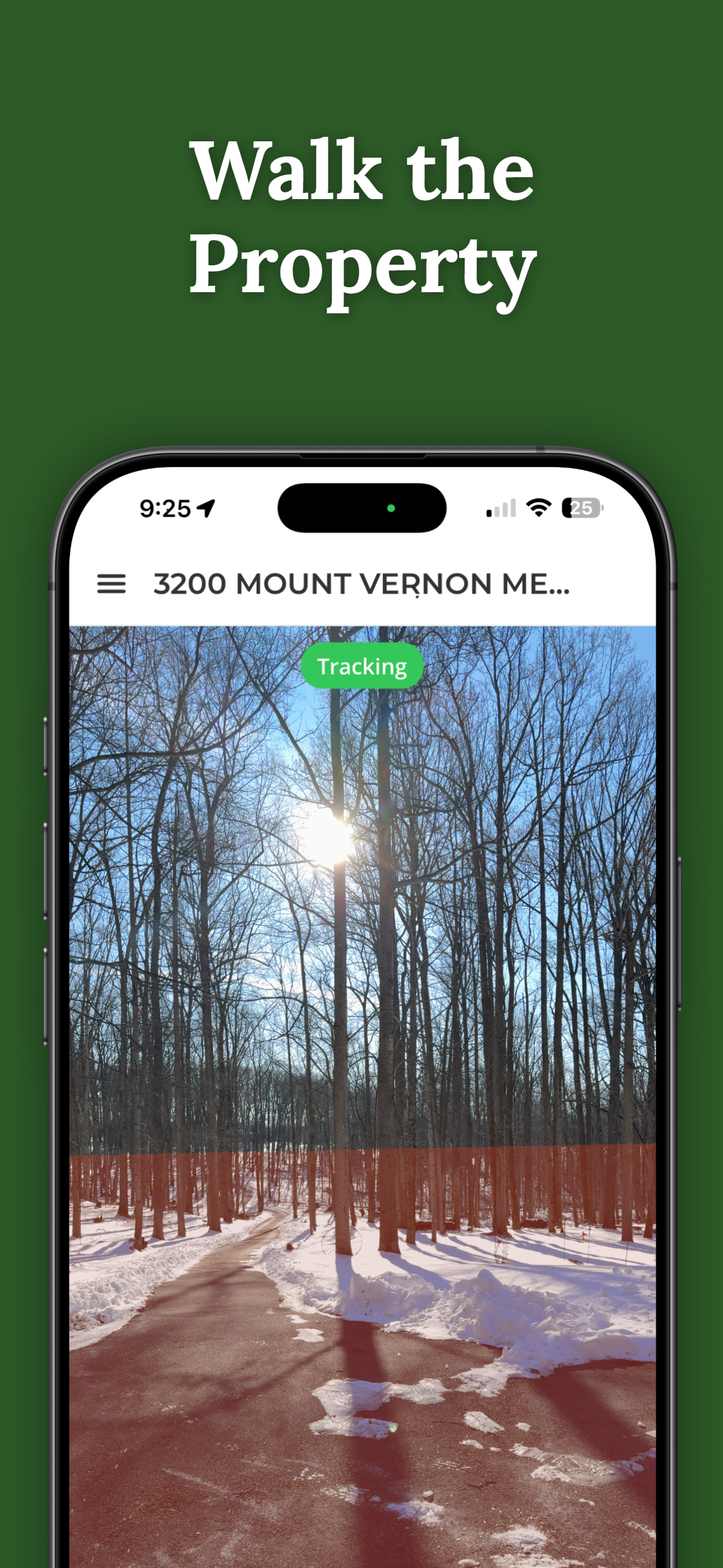
Use a Property Line App
There are phone apps now that overlay parcel data onto a map or even project boundary lines through your camera using AR. They're handy for walking a property and getting a visual sense of where lines fall.
The catch: your phone's GPS is only accurate to about 10-15 feet, so don't use an app to decide exactly where to pour a foundation. But for getting oriented on a piece of land? They're genuinely useful. We break down the options in can you find property lines on your phone.
When You Actually Need a Survey
Everything above works for general reference, but some situations demand the real thing:
- You're building something that needs a permit
- You're in a boundary dispute with a neighbor
- You're selling or subdividing land
- You want a fence exactly on the line and don't want a legal headache later
- Your lender or title company requires an ALTA survey
A licensed surveyor's work holds up in court. If real money or a real disagreement is involved, spend the money.
How ParcelVision Helps
ParcelVision shows property boundaries in AR on your iPhone. Enter an address, point your camera at the land, and the boundary lines appear overlaid on the real world. It's a fast way to see where your lines are without waiting weeks for a surveyor.
Download on the App StoreThis article is for informational purposes only and isn't legal advice. If you're dealing with a dispute, construction project, or real estate transaction, talk to a licensed surveyor or attorney.