ParcelVision
How to Read a Property Plat Map
A plat map shows how a piece of land was divided into individual lots — including boundaries, dimensions, easements, and rights-of-way. To read one, find your lot number first, then look at the boundary measurements and any notations about setbacks or easements that affect what you can do with the property.
The first time you look at a plat map, it's a lot. Lines everywhere, tiny numbers crammed along every edge, weird compass notations like "N 45 30' E" — it feels like someone handed you a treasure map written in a language you don't speak.
But here's the thing: once someone walks you through the pieces, it all snaps together. And knowing how to read your plat map is genuinely useful — for planning a fence, understanding an easement, or just making sense of what you actually own. So let's break it down.
What Is a Plat Map?
A plat map — sometimes called a subdivision plat or recorded plat — is basically a blueprint showing how a larger piece of land was sliced up into individual lots. A developer decides to build a neighborhood, a licensed surveyor draws up the map, and it gets filed with the county recorder's office. From that point on, it's a public record that defines every lot in that subdivision.
Think of it as the master plan. It shows the whole neighborhood, not just your lot. That's one way it differs from a property survey, which zooms in on a single parcel and includes details like buildings, elevations, and encroachments.
Where to Find a Plat Map
Getting your hands on one is easier than you'd think:
- County recorder's office — The official source. Most counties have recorded plats going back decades. You can visit in person or call to request a copy.
- County assessor or GIS portal — Tons of counties have plat maps online now. Search for your county name plus "GIS" or "property search" and poke around.
- Title company — Bought your house recently? Your title company probably has a copy buried in your closing file.
- Local planning department — The planning and zoning office often has plats on file, especially for newer developments.
Key Elements of a Plat Map
Alright, you've got the map in front of you. Here's what you're looking at.
Lot Numbers and Block Numbers
Every parcel gets a lot number, and lots are grouped into blocks. Your deed references these — something like "Lot 12, Block 3, of Oakwood Estates." Step one is simply finding your lot on the map. Everything else flows from there.
Boundary Lines and Dimensions
The solid lines on the map are your lot boundaries. Along each line, you'll notice two pieces of information:
- Distance — The length of that boundary segment, shown in feet and decimals (like 125.50'). Pretty straightforward.
- Bearing — The direction the line runs, written as a compass bearing. Something like "N 45° 30' E" means the line goes from south toward north, angled 45 degrees and 30 minutes to the east. Bearings always start from North or South and angle toward East or West. It looks confusing the first time, but it's just a way of describing the direction of each line segment.
Here's the neat part: if you follow each boundary line in order — distance and direction, distance and direction — they form a closed shape that brings you right back to where you started. That's your lot.
Easements and Rights-of-Way
You'll probably notice some dashed lines or shaded strips running along or through lots. Those are easements — areas where someone other than you has the right to use your land. The most common types:
- Utility easements — Usually 5- to 10-foot strips along lot edges where the electric, gas, or cable company can install and maintain their lines.
- Drainage easements — Areas reserved for stormwater to flow through.
- Access easements — Paths or roads that give access to landlocked parcels behind yours.
- Rights-of-way — Land set aside for public roads, sidewalks, or trails.
Pay attention to these. You own the land underneath an easement, but you can't build on it. People find this out the hard way when they put up a shed on a utility easement and get told to move it.
Setbacks
Some plat maps show building setback lines — the minimum distance your structure has to be from the lot boundary. A 25-foot front setback means nothing you build can be closer than 25 feet from the front property line. If your plat map doesn't show setbacks, don't assume there aren't any. Check your local zoning code, because they still apply whether they're drawn on the map or not.
Common Symbols and Notations
Plat maps vary a bit by region, but you'll see these symbols over and over:
- Solid lines — Property boundaries and lot lines
- Dashed lines — Easements, setback lines, or centerlines
- Small circles or dots — Survey monuments or iron pins set at corners
- Curved lines with radius notations — Curved boundaries, usually along cul-de-sacs. These get a little more math-heavy, with radius, arc length, and chord bearing listed
- North arrow — Shows which way the map is oriented
- Scale bar — Lets you estimate real-world distances from the map
Most plat maps include a legend explaining the symbols, plus a title block with the subdivision name, surveyor info, date, and recording details. If you're confused by a symbol, the legend is your friend.
How a Plat Map Differs from a Survey
People mix these up all the time, and they're really two different things:
- A plat map shows how land was originally divided into lots. It covers a whole subdivision and is a recorded public document.
- A property survey is a detailed look at one specific parcel. It might show buildings, fences, driveways, and any encroachments. It's prepared for an individual property owner and goes into much more detail.
A plat map is a great starting point for understanding your boundaries. But if you need exact measurements — or you're trying to resolve a dispute — a professional survey is the next step.
How ParcelVision Helps
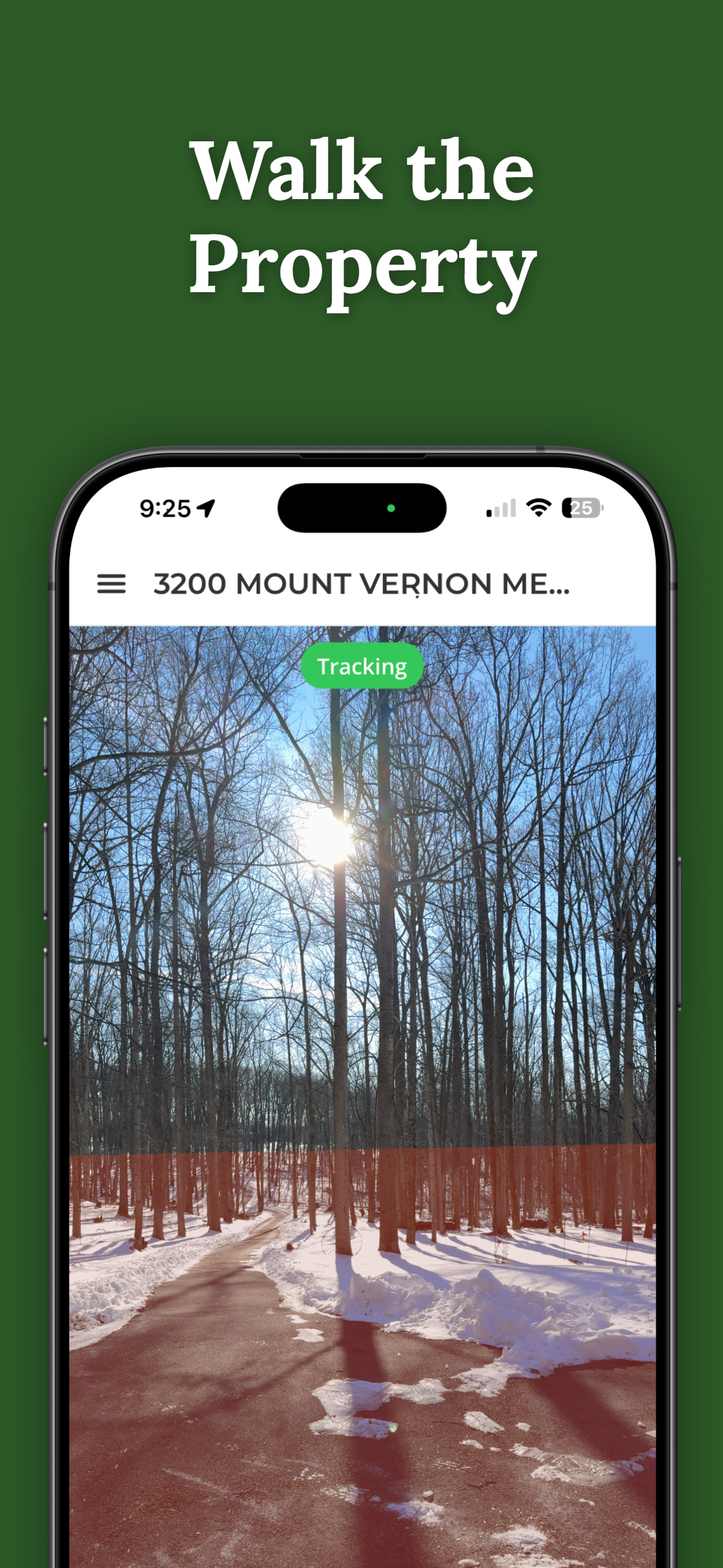
Reading lines on a plat map is one thing. Seeing those boundaries in the real world is another. ParcelVision uses AR to overlay property lines right onto your iPhone's camera view — so instead of squinting at a paper map, you can walk your land and see where your lot lines actually fall. It's a fast way to get oriented before deciding if you need a formal survey.
Download ParcelVisionThis article is for informational purposes only and isn't legal advice. Plat maps are helpful reference documents, but talk to a licensed surveyor if you need official boundary determinations.