ParcelVision
ParcelVision vs Hiring a Land Surveyor: When Do You Need Each?
ParcelVision costs $14.99 per property and shows you boundary lines instantly on your iPhone using augmented reality. A professional land survey costs $300 to $800 or more and takes two to four weeks, but it produces a legally binding document. Use ParcelVision for everyday boundary checks and exploring land. Hire a surveyor when you need legal precision for disputes, construction, or real estate closings.
| Feature | ParcelVision | Land Survey |
|---|---|---|
| Cost | $14.99 per property | $300 - $800+ |
| Time to Results | Instant | 2 - 4 weeks |
| Accuracy | Based on public parcel data | Sub-foot precision |
| Legal Standing | Reference only | Legally binding |
| Best For | Quick boundary checks, exploring land | Legal disputes, construction, real estate closings |
What Each Option Offers
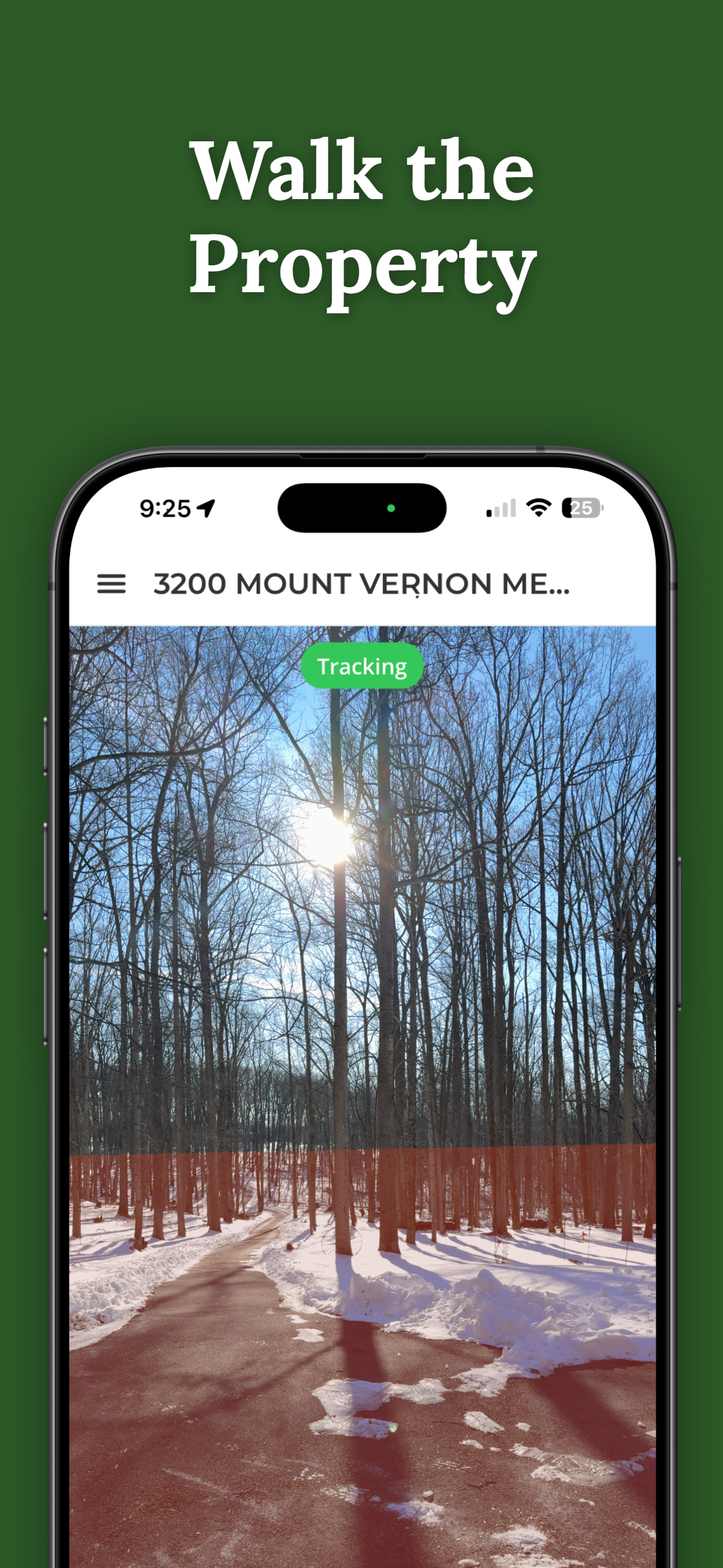
ParcelVision is an iOS app that lets you visualize property boundary lines on your iPhone using augmented reality. You enter an address, and the app overlays the parcel boundaries onto your camera view so you can see where the lines fall as you walk the property. It pulls data from public parcel records and displays it instantly. At $14.99 per property, it is designed for people who need a quick, affordable way to understand their boundaries without waiting weeks or spending hundreds of dollars.
A professional land survey is performed by a licensed surveyor who researches your legal property description, travels to your land, and uses precision instruments to measure and mark the exact boundaries. The result is an official survey document that holds up in court, satisfies lender requirements, and can be recorded with your county. It is the gold standard for establishing where your property legally begins and ends.
Cost Breakdown
The cost difference between these two options is significant. ParcelVision is a one-time purchase of $14.99 per property. You can access the boundary data and AR visualization as often as you want after that, and you can share it with family members, hunting partners, or anyone else at no additional cost.
A standard residential boundary survey typically costs between $300 and $800, though prices vary by region, property size, and terrain. Larger rural properties, heavily wooded lots, and parcels with unclear legal descriptions can push costs above $1,000. ALTA surveys required for commercial transactions often run $1,500 to $3,000 or more. You will also need to wait two to four weeks from scheduling to receiving the final survey document, and longer during busy seasons.
For someone who simply wants to know where their yard ends or wants to walk a potential purchase before committing, a $300-plus survey is often more than the situation calls for. That is where ParcelVision fills the gap.
Accuracy and Legal Considerations
This is where honesty matters. ParcelVision relies on publicly available parcel data, which is maintained by county assessors and GIS departments. This data is generally reliable for showing the approximate location of boundaries, but it is not survey-grade. GPS accuracy on a phone, combined with the inherent precision of public parcel data, means the lines you see are a useful reference but not exact to the inch.
A licensed land survey, on the other hand, produces measurements with sub-foot accuracy. The surveyor sets physical markers at your property corners and prepares a document that is legally defensible. If you are involved in a boundary dispute with a neighbor, applying for a building permit, or closing on a real estate transaction, you need that level of precision and legal standing. ParcelVision cannot replace a survey for those purposes.
Speed and Convenience
ParcelVision delivers results immediately. You download the app, enter an address, purchase the property card, and you are looking at boundary lines within minutes. You can walk the entire property with the AR view, share the boundaries with others, and revisit the data anytime. There is no scheduling, no waiting, and no need to be home for a crew to visit your property.
A professional survey requires calling around for quotes, scheduling an appointment (often weeks out), being available when the surveyor visits, and then waiting for the final document to be prepared. During peak seasons in spring and summer, wait times can stretch even longer. If you need information quickly, a survey simply cannot match the immediacy of an app-based solution.
When to Use ParcelVision
ParcelVision is the right choice when you need a fast, affordable boundary reference without legal requirements. Common situations include:
- Everyday boundary checks: Understanding where your property ends and your neighbor's begins for routine yard work, gardening, or general awareness.
- Exploring land before buying: Walking a property you are considering purchasing to get a feel for its size, shape, and boundary locations before committing to a full survey.
- Planning a fence or landscaping: Getting a general sense of where the property line falls so you can plan placement and decide whether a formal survey is warranted.
- Hunting and outdoor activities: Knowing where property boundaries are in the field so you stay on the right side of the line while hunting, hiking, or managing timber.
- Sharing boundaries with others: Showing family members, hunting partners, or land managers where the property lines fall without needing to schedule and pay for a survey each time.
When to Hire a Land Surveyor
A professional survey is the right call when accuracy and legal standing are non-negotiable. You should hire a licensed surveyor for these situations:
- Legal disputes: If you and a neighbor disagree about where the boundary falls, only a licensed survey will hold up in court or mediation.
- Construction permits: Most municipalities require a current survey before issuing permits for new construction, especially for structures near the property line.
- Real estate closings: Lenders and title companies often require a survey to issue title insurance or approve a mortgage, particularly for ALTA coverage.
- Subdividing property: Splitting a parcel into multiple lots always requires a licensed survey and a new recorded plat.
- Establishing legal boundaries: When you need permanent, legally recognized corner markers set in the ground with an official document to back them up.
In many cases, the two options are not competing. They serve different purposes. ParcelVision helps you understand your boundaries quickly and affordably for everyday situations, while a professional survey provides the legal documentation you need when the stakes are higher.
Try ParcelVision First
Before spending $300 or more on a land survey, use ParcelVision to see your property boundaries instantly in augmented reality. For $14.99, you get an immediate visual reference that helps you decide whether a full survey is necessary for your situation.
Download on the App StoreThis comparison is for informational purposes only. ParcelVision provides boundary visualization for reference and does not replace a professional land survey. Boundary data is sourced from public records and may not reflect current conditions. Contact a licensed surveyor for legally binding boundary determinations.